 EMODnet Product Catalogue
UK Admiralty Chart Datum
Type of resources
Available actions
Topics
Keywords
Contact for the resource
Provided by
Years
Representation types
Scale 1:
Resolution
-
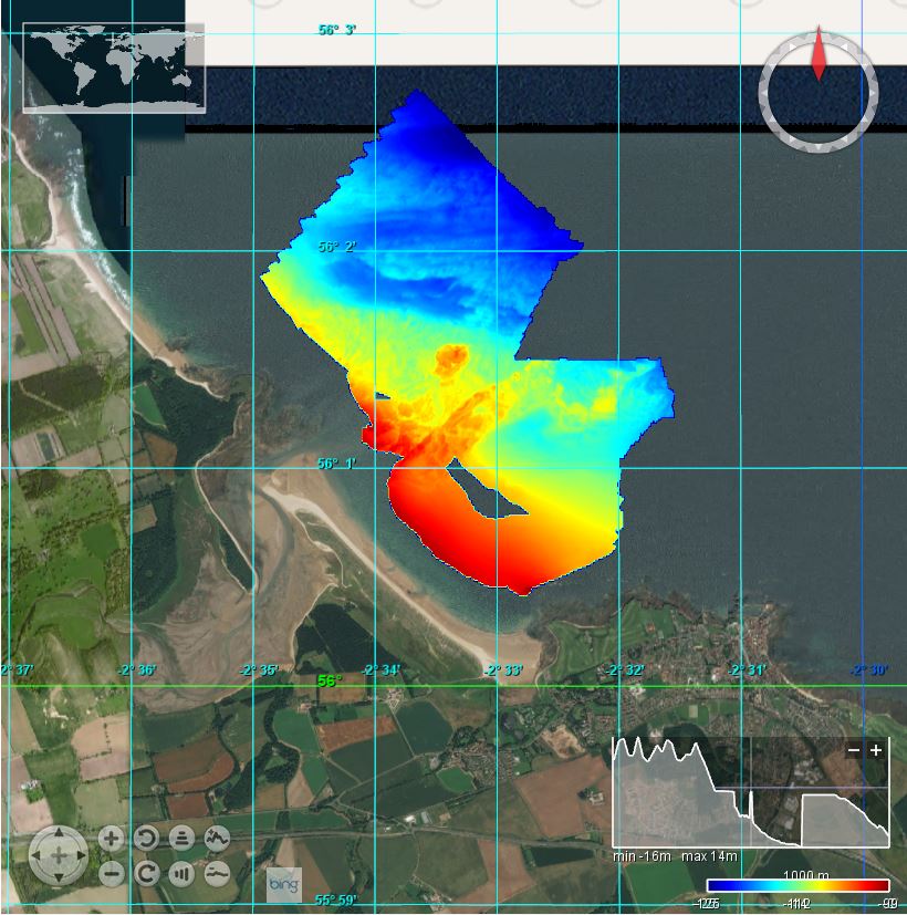
This BGS marine multibeam survey took place in May/June 2013 in the area of Isle of May, Anstruther and the Firth of Forth on board the RV White Ribbon. The survey was carried out by the British Geological Survey (BGS). Sea floor bathymetry data were collected using a Kongsberg EM3002D multibeam system to IHO Order 1A. Bathymetric data on MV White Ribbon was acquired by the British Geological Survey (BGS) using a Kongsberg EM3002D dual head, multibeam echosounder system (MBES). Data were acquired using the Kongsberg SIS operating system, logging raw .ALL files. Offline data processing was performed using CARIS HIPS and SIPS 7.1 SP2
-
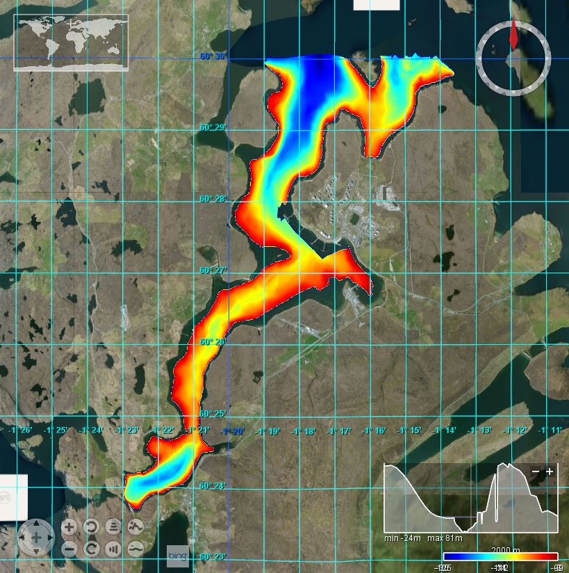
This marine multibeam and geophysical survey took place from 13-04-15 to 27-04-15 in the area of Sullom Voe, Shetland on board the RV White Ribbon. The survey was carried out by the British Geological Survey (BGS) on behalf of the BGS Marine team. Bathymetric data on MV White Ribbon was acquired using a Kongsberg EM3002D multibeam echosounder system. Kongsberg Seafloor Information System (SIS) version 3.9.2 (build 187) was used for online data logging. A Trimble SPS461 with Fugro Marinestar licence and a Kongsberg Seatex Seapath 200 provided vessel position, heading and attitude. Offline data processing was performed using CARIS HIPS version 8.1.5.
-
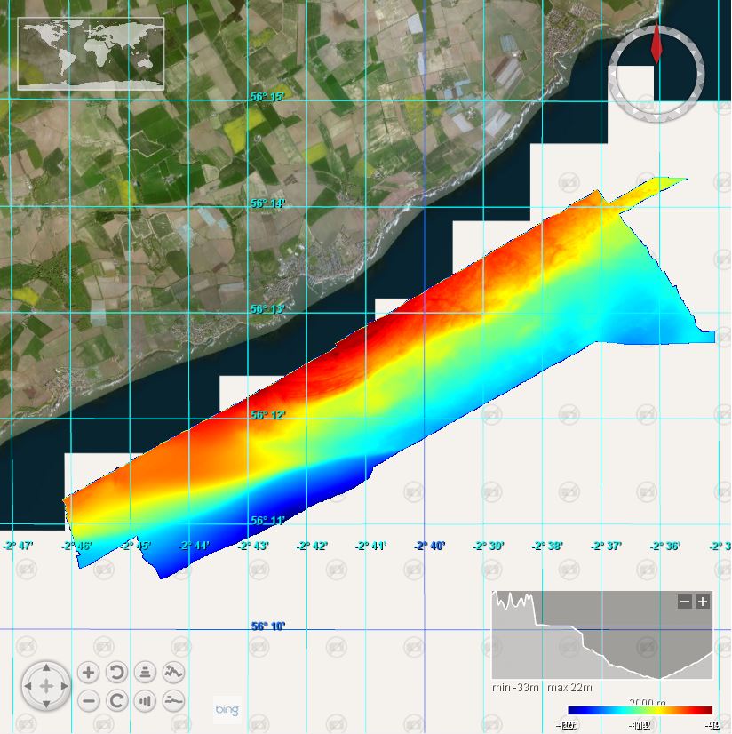
This marine multibeam survey took place from 15/06/2015 - 23/06/2015 in the area off Belhaven Beach near Dunbar, The Lothians, on board the RV White Ribbon. The survey was carried out by the British Geological Survey (BGS) on behalf of BGS. The aim of the project was to survey the near-shore region at Belhaven Bay to establish the extent of the sand shore face below low tide. The survey forms part of the Tyne Catchment Project, which aims to understand the dynamics of sediment sourcing, mobilisation, transport and deposition in the catchment of the East Lothian Tyne. Sea floor bathymetry data were collected using a Kongsberg EM3002D multibeam system.
-
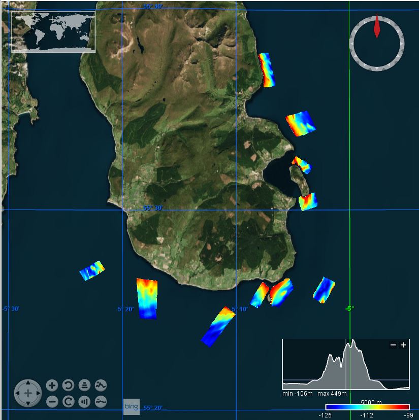
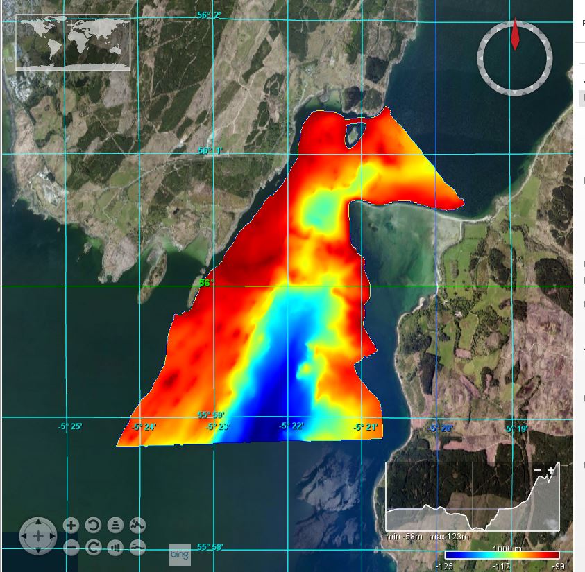
This survey area was part of a multibeam bathymetry carried out by the British Geological Survey on behalf of Scottish Natural Heritage between 25/11/2015 and 17/04/2016. A bathymetric and side scan sonar survey was undertaken using the survey vessel White Ribbon. The aim was to establish baseline mapping of the seabed (examining habitat heterogeneity and fisheries marks) within the target areas prior to the implementation of new management measures.
-
This survey area was part of a multibeam bathymetry carried out by the British Geological Survey on behalf of Scottish Natural Heritage between 25/11/2015 and 17/04/2016. A bathymetric and side scan sonar survey was undertaken using the survey vessel White Ribbon. The aim was to establish baseline mapping of the seabed (examining habitat heterogeneity and fisheries marks) within the target areas prior to the implementation of new management measures.